- DSpace Home
- →
- Channel Islands
- →
- Broome Library Collections
- →
- Ventura County Environmental Collections
- →
- Lupé Anguiano
JavaScript is disabled for your browser. Some features of this site may not work without it.
| dc.contributor.author | Clearwater Port | en |
| dc.date.accessioned | 2011-02-08T17:58:26Z | en |
| dc.date.available | 2011-02-08T17:58:26Z | en |
| dc.date.issued | 2006 | en |
| dc.identifier.uri | http://hdl.handle.net/10139/3162 | en |
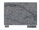
| dc.description.abstract | Two maps that depict proposed offshore pipeline route for BHP Billiton's LNG terminal. | en |
| dc.language.iso | en_US | en |
| dc.publisher | Clearwater Port | en |
| dc.rights | All rights reserved. Broome Library, CSU Channel Islands. | en |
| dc.subject | Pipeline map | en |
| dc.subject | Liquefied Natural Gas (LNG) | en |
| dc.subject | Ventura County, California | en |
| dc.subject | Ventura Harbor | en |
| dc.subject | BHP Billiton | en |
| dc.subject | Clearwater Port | en |
| dc.title | Proposed Offshore Pipeline Route Map | en |
| dc.type | Map | en |
Files in this item
This item appears in the following Collection(s)
-
Lupé Anguiano [229]
(Finding Guide available)